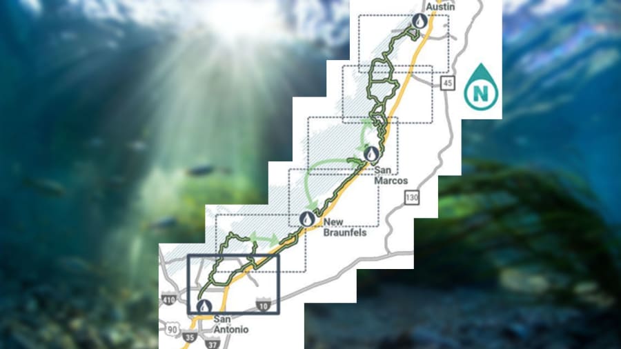
SAN ANTONIO – The Great Springs Project has released a plan for its proposed 100-mile hiking trail that will connect Austin and San Antonio.
Referred to as a “green corridor” the proposed project would connect Barton Springs, San Marcos Springs, Comal Springs, and San Antonio Springs.
Recommended Videos
According to a trail plan from the Great Springs Project, some portions of the trail are already built like the Violet Crown Trail in Austin and the Dante Trail in San Marcos’ Purgatory Creek Natural Area in San Marcos.
The trail plan is a living document, however, meaning that it will be updated frequently until the trail’s estimated completion date sometime in 2036. Alta Planning + Design is helping to assist with the trail plan design.
Great Springs Project CEO, Garry Merritt, calls the trail plan “the blue print for building the trail from the Alamo to the Capitol.”

A press release from the Great Spring Project notes that in some places, trail alignments have been planned by local communities and in other areas alignments still need to be determined.
Getting private landowners to agree on public access to their properties, especially along that large of a stretch of land, is a massive undertaking and is historically difficult.
Project leaders are banking on tax cuts for landowners to help push the project forward in terms of securing land.
Sections of the trail will likely be built in phases, with the order of phases depending on key factors such as funding, landowner negotiation, establishing right-of-way, permitting, design, and construction, Great Springs Project organizers said in a Facebook post.
“Community, connectivity, and conservation are at the heart of Great Springs Project,” said executive director of Texas Parks and Wildlife Carter Smith. “Texas Parks & Wildlife is proud to support this regional vision that honors and protects the rich history, culture, and natural resources of Texas’ famed Hill Country.”
A previous press release from the U.S. Department of the Interior states that the goal of the Great Springs Project is to add an additional 50,000 acres of protected lands over the Edwards Aquifer recharge and contributing zones between the dense urban areas of Austin and San Antonio.
“As the Central Texas region grows together, Great Springs Project is absolutely the best hope for a permanent, unifying, and essential greenspace that demonstrates our respect for our land, our natural resources, our history, our outdoor spirit, and our commitment to the common good,” former San Antonio Mayor Henry Cisneros said.
As for how the project will be funded, Great Springs leaders say large philanthropic donations, in addition to federal money, will be necessary to complete the vision.
Ultimately, the Great Springs Project hopes to unify existing local efforts while addressing critical water, land, wildlife, and public health challenges that face the Central Texas Region, the project’s website states.
In 2020, the project surpassed several political milestones as well with the passing of Prop A and Prop B in Travis County, which helped secure the transformation of Austin’s transportation structure, ensuring safe mobility for Texans.
Prop A was also passed in Hays County, which helps ensure the protection of rivers, creeks and springs in the area as well as allocate funds for the creation of new parks, protection of open spaces, and preservation of natural areas.
“Estimating a single total cost for the GSP trail network is not recommended at this stage in the process. There are many variables and details related to feasibility, design, and construction that will need to be determined for individual sections of trail before reasonably reliable figures could be generated,” according to the trail plan.
One of the ultimate goals of the Great Springs Project is to develop a trail network that is safe, equitable and accessible to people of all ages and abilities.
“Nature created Great Springs; Texans are blazing the trail,” said Great Springs Project board member Tim McClure.


