

San Antonio’s history is marked by frequent flooding, but a handful of rain events have truly rewritten the history books.
The June 12 flood was historic in many ways. With 13 people killed, it was one of the deadliest in San Antonio. Also, it was the 10th rainiest day of all time.
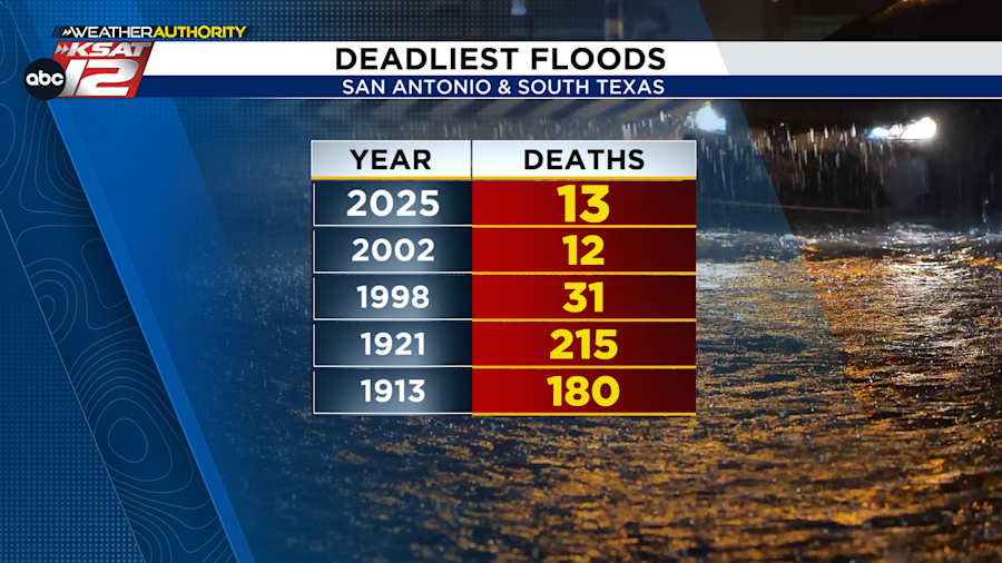
However, no flooding event was as pivotal as the 1921 flood, which not only reshaped the city’s landscape but also spurred the development of the iconic River Walk.
Here’s what else to know about San Antonio’s historic floods:
Flood of 1913
Watch Justin Horne’s “On This Day In Weather History” lookback on the 1913 flood in the video player above.
The Dec. 3, 1913, flood left much of downtown San Antonio underwater.
Between 10 and 15 inches of rain fell from Marble Falls to Austin to New Braunfels, leading to rising floodwaters in waterways.
It was devastating to the area, as flood waters rose for the second time in three months.
At the time, 180 people died.
Flood of 1921
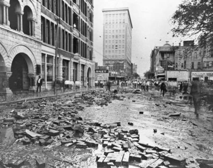
The River Walk owes its existence to the 1921 flood.
As you might have guessed, this event had a tropical connection. On Sept. 7, well south of San Antonio, a Category 1 hurricane made landfall south of Tampico, Mexico. The energy from the tropical system raced northward. By Sept. 8, rainfall in San Antonio had begun. The heaviest rainfall fell on Sept. 9.
According to the U.S. Geological Survey, San Antonio first recorded rain on the morning of Sept. 8. In total, 0.54 inches was reported that day. The following day, 5.38 inches fell and initiated the flooding. Sept. 10 brought an additional 1.46 inches. The grand total was 7.38 inches.
You might be thinking that doesn’t seem that bad, but keep in mind that San Antonio was a growing city without any flood control at the time.
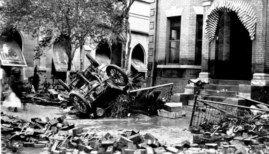
A total of 215 people lost their lives in San Antonio and South Texas. Locally, more than $3 million in property was destroyed.
Water as deep as 10 feet in the downtown area flooded buildings and homes, according to the USGS.
The flood spurred change. City planners realized that flood control was needed to prevent future tragedies. Plans to build the Olmos Dam were started. A bypass channel through downtown was also designed to protect against flooding along the San Antonio River. Plans included cementing over and covering the storm sewer.
Famously, architect Robert Hugman proposed putting businesses along the channel instead of paving over the waterway. He would eventually move forward with his idea, creating what is now the world-famous River Walk. The two projects proved invaluable during subsequent flood events.

Flood of 1998
Watch KSAT’s documentary on the flood in the video player above
The 500-year flood — that’s what we saw back on Oct. 17, 1998.
The devastating weather event resulted in 31 deaths and $1.19 million in damage.
It started raining overnight and by Saturday morning on Oct. 17, major flooding was already covering much of the area.
But that was just the beginning — the Alamo City officially got 11.26 inches of rain that day and more than 15 inches by the time all was said and done.
Read former KSAT meteorologist Mike Osterhage’s firsthand account of the flood at this link.
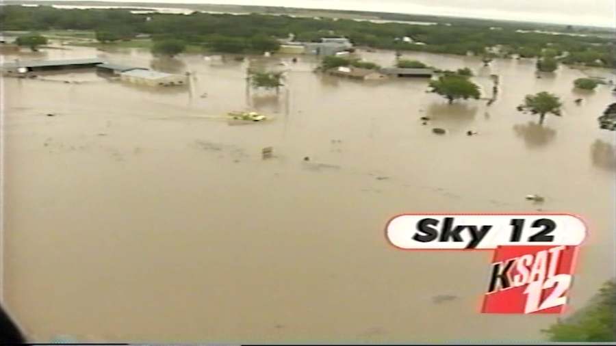

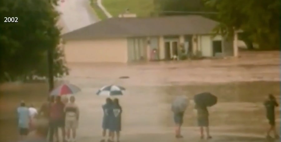
Flood of 2002
Watch Patty Santos’ coverage of the 20-year anniversary of the flood in the video player above
During the Fourth of July flood in 2002, rain began to fall and didn’t stop for several days until some parts of South Texas had received more than a year’s worth of rain.
By June 30, heavy rain affected parts of the Hill Country and extended to Austin and San Marcos, according to the National Weather Service. On July 1, intense thunderstorms brought record rainfall, with San Antonio International Airport receiving 9.52 inches, surpassing the previous July record.
Flooding occurred across the Hill Country and South Central Texas. After a brief lull, more heavy rains returned on July 2 and continued into the early morning of July 3, causing additional flooding. Although the rain eased on July 4, it intensified again that evening and into July 5, leading to further flooding in the area.
Twelve people died in the San Antonio area and South Texas.
The City of New Braunfels is in the heart of what is known as “Flash Flood Alley.”
The 2002 flood wreaked havoc on this community, causing millions of dollars worth of damage in and around the city.

Flood of 2013
Do you remember when Highway 281 was under water? It happened during Memorial Day weekend in 2013, when more than 17 inches of rain fell on the Olmos Basin.
The highway was closed for several days.
Rain fell on the morning of May 25, 2013, and it would not let up. All that water had nowhere to go, and all that flooding led to a rise on the San Antonio River along Mission Reach.
Two people died and more than 300 homes were impacted, with 15 homes destroyed.
This event and the Wimberly flood of 2015 are some of the reasons why, in San Antonio, we associate Memorial Day with bad weather.

