
SAN ANTONIO – Should it have been a surprise?
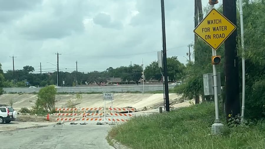
The westbound Loop 410 access road where 15 cars were swept into Beitel Creek on June 12 is in a floodplain. So, why is there no warning system for drivers, like there are at low-water crossings, such as the nearby Vicar Drive?
The San Antonio River Authority has finished a technical assessment of the Beitel Creek flood, which will be used in the city’s ongoing investigation into the flooding that killed 13 people — 11 of them in the Beitel Creek area alone.
>> Mapping the deadly June 12 Beitel Creek flood that killed 11 people
As part of the assessment’s conclusion, the river authority recommended, “Roads adjacent to the floodplain should be evaluated for flood risk and considered for mitigation options including high water detection.”
Floodplain maps help identify areas with the highest risk of flooding by modeling where water would flow during a 100-year flood event, a term referring to a flood with a 1% chance of occurring in a given year.
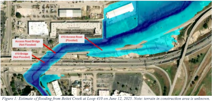
Draft maps on the San Antonio River Authority’s website show more than 400 yards of the westbound access road sitting in that floodplain.

Even so, the access road is not the typical candidate for a high water detection system, which can activate light-up signs to warn off drivers. Crossings at Old O’Connor Road and Vicar Drive, upstream and downstream of where the cars were swept away, have such systems.
However, the access road did not flood where it crossed the creek, according to the San Antonio River Authority’s analysis. Instead, it was the stretch before the bridge, where the flood maps predicted, that flooded.
Along that stretch, where the road and creek run parallel to each other, is where cars got stuck or swept away.
“It’s not unreasonable to expect (the creek to flood) because it is — yeah, that is part of the floodplain in that area," Steven Metzler, director of San Antonio River Authority of Water Resources, told KSAT.
Metzler said that numerous crossings in the county and state lack warning systems despite being located in floodplains.
“The more advanced warning we can give to people, the better off everyone’s going to be,” Metzler said.
When asked why a gauge or warning system wasn’t installed on that portion of the road, given its floodplain location, Metzler said, “That’s a good question for (sic) to ask the ownership of that particular area.”
KSAT emailed and called Laura Lopez, a spokeswoman for the Texas Department of Transportation San Antonio District, on Tuesday and Thursday, seeking answers about the absence of such protections on the highway’s access road.
Lopez initially referred KSAT to a previous statement she had sent on behalf of the state agency, which did not directly mention a high water system.
“The drainage systems on state infrastructure functioned properly. It’s important to emphasize that this was a historic event, bringing an extraordinary amount of rainfall in a very short period, overwhelming natural waterways and drainage systems across the region. We remain committed to working with local partners to support ongoing investigations and to ensure that infrastructure planning continues to prioritize public safety.”
TxDOT
She did not respond to further requests for comment Thursday after KSAT obtained the river authority’s assessment.
The report notes that parts of the upstream Beitel Creek watershed received more than 7.1 inches of rain in three hours, enough to be considered a 100-year storm event.
However, the average rainfall across the entire watershed was 5.06 inches, which is above the threshold for a 10-year, six-hour storm event.
“Because it was overall a 10-year event, the creek was able to carry the vast majority of that rain event,” Metzler said. “By the time it got down to the area near the frontage road — westbound frontage road — (it) was between a 10 and 25-year runoff event.”
San Antonio River Authority modeling of the flood appears to estimate that the creek reached its highest point near the access road at around 6 a.m.
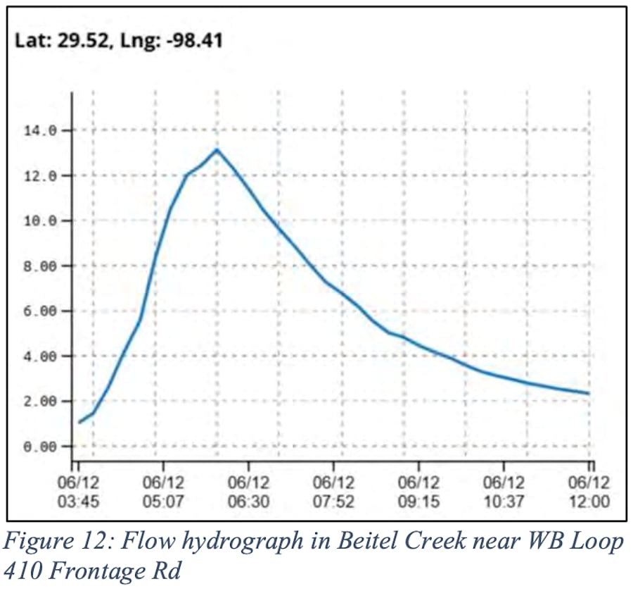
A KSAT camera captured two cars being carried into the creek at around 5:20 a.m., as well as someone wading through chest-high water — higher than the 2.3 feet the river authority estimated as the flood’s deepest point.
However, the river authority report notes that while drainage from street and construction areas may have contributed to the flood, they were not included in this assessment.
The San Antonio River Authority report will be shared with Kleinfelder, Inc., the engineering firm hired by the city to investigate the flooding, to help with its analysis.
Read the full report below:
More recent coverage of this story on KSAT:

