

FORECAST HIGHLIGHTS
- DROUGHT UPDATE: Reasons for minimal improvements explained below
- BRIEF, STRAY SHOWERS: Daily, mainly SE of San Antonio
- TEMPERATURES: Near average
- HOTTER IN DETROIT: Heat high shifts NE, Detroit to be hotter than SA 🤯
FORECAST
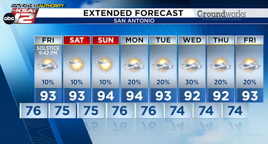
We have daily rain chances, but they’re on the low-end ranging from 10%-30% especially southeast of San Antonio. That said, a few splash-n’-dash showers could pop-up around Bexar County, but they wouldn’t have an impact on the drought situation.
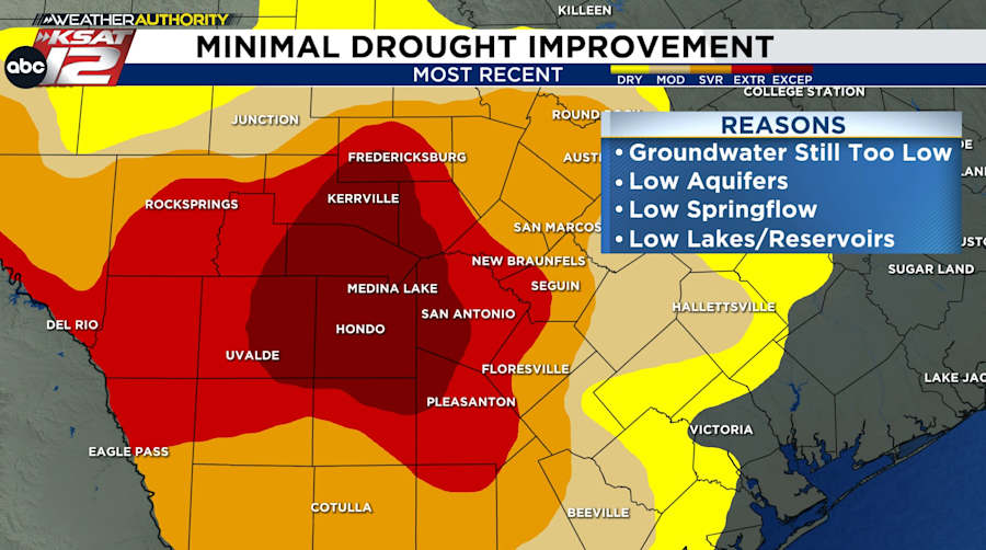
DROUGHT UPDATE
Sure, we’ve greened up, but groundwater levels remain low. Despite above average rainfall and flash flooding, the new drought monitor (issued Thursday morning) indicates little improvement for South-Central Texas because groundwater levels are still too low. Basically, the aquifers, springflows, and lake/reservoir levels remain too far below average to cause much improvement in our drought. Though the current mosquito population would disagree😆
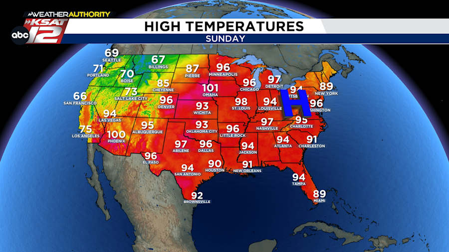
DETROIT TO BE HOTTER THAN SA
The infamous “heat high” will soon move past Texas and park itself over the Eastern U.S. This pattern means near average temperatures in San Antonio, but hotter and record challenging temperatures as far north as Detroit and Minneapolis.
We’ll keep you posted on any changes!

KSAT meteorologists keep you on top of the ever-changing South Texas weather.
QUICK WEATHER LINKS
- Download FREE KSAT Weather Authority App: Up-to-date forecast information and livestreams from trusted local meteorologists.
- KSAT Connect: Share your weather photos.

