
WATCH LIVE RADAR IN THE VIDEO ABOVE
HIGHLIGHTS
- GUADALUPE RIVER: Fast streamflow from Kerr county, through Comal
- RUNOFFS: With more rain Sunday, the creeks and runoffs could slowly rise
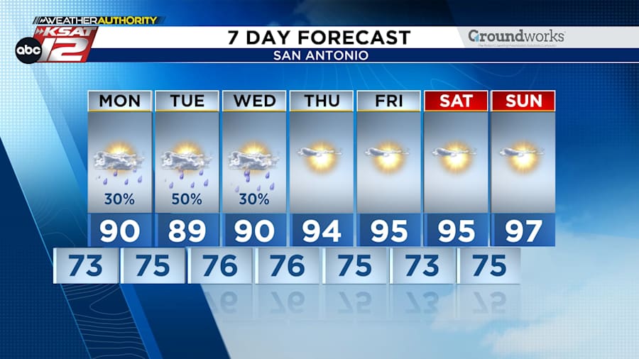
- RAIN CHANCES: Continue through Wednesday
FORECAST
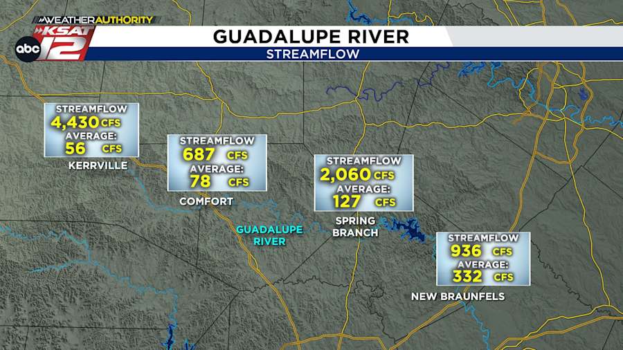
GUADALUPE RIVER
While the river is receding, we are still seeing very high streamflow along the river - upstream AND downstream from Canyon Lake. Please use caution if you are by the Guadalupe today.
AREA LAKES
We are seeing a rise in local reservoirs, even if it’s a small one. Canyon Lake and Lake Travis are responding most to the rainfall -- up 10 to 20 feet since July 4. Medina Lake has also risen, but is still less than 5% full.
MONDAY
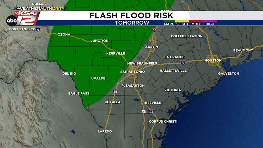
The same upper-level, rainmaking energy that brought deadly flooding July 4th will continue to spin above Central Texas and the Texas Hill Country Sunday.
The coverage of rain may not be as extensive tomorrow (40%), but flash flooding could still happen quickly. Areas of 2″-4″ and locally higher amounts are most likely along and west of Hwy 281 including the Hill Country.
WEEK AHEAD
We’ll keep rain chances in the forecast through Wednesday, before drying out.
QUICK WEATHER LINKS
- Download FREE KSAT Weather Authority App: Up-to-date forecast information and livestreams from trusted local meteorologists.
- KSAT Connect: Share your weather photos.

