
FORECAST HIGHLIGHTS
- TODAY: Partly cloudy, temps in the mid 90s.
- SUNDAY: Brief showers, storms in evening for northern Hill Country.
- AFTER TUESDAY: Rain chances very important to watch.
FORECAST
THE MORNING RUN
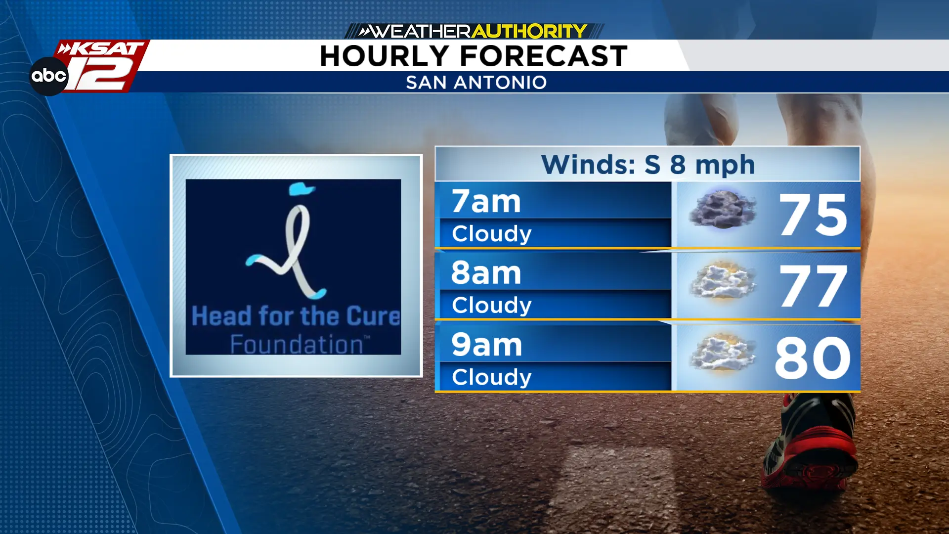
If you’re heading out this morning for the Head for the Cure 5K, we’ve got some nice weather for you. Conditions are going to be muggy until about 9 AM, but temperatures will be mostly in the mid to upper 70s. The humidity will make it hard to cool down, so having a cool towel could help your body cool down. Good luck to all the runners this morning!
Afternoon high temperatures will reach close to 95 degrees in San Antonio. Skies will be mostly to partly cloudy, and we’re not expecting rain showers today.
SUNDAY SHOWERS?
Tomorrow will turn out to be a fairly nice day with highs in the mid 90s. Rain is not expected for the majority of us, but a quick shower or storm could develop for northern Hill Country areas. Better chance for this activity is between 4 PM and 8 PM, if any is seen at all.

NEXT WEEK
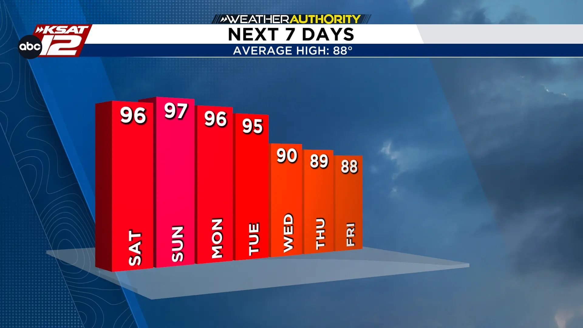
We’ll be looking at two different types of patterns for us next week. Hot and mostly dry turns to increasing rain chances that could help cool us off in the back half of the week. The days that we are watching closely will be Wednesday, Thursday, and Friday. While a strong cold front is not forecasted to reach to San Antonio, a weak frontal boundary could move just close enough to initiate next week’s activity.

RAIN POTENTIAL
Next week’s rainfall will more than likely be initiated by a front. The heaviest rain will be closer to where the front stalls, but the question is WHERE. It’s going to take more time to find that answer, so make sure to keep checking in as the forecast evolves. The rain amounts you see here are not a exact, neither is their location. We’re just starting to establish the idea that we could have the potential for some drought denting rain.


KSAT meteorologists keep you on top of the ever-changing South Texas weather.
QUICK WEATHER LINKS
- Download FREE KSAT Weather Authority App: Up-to-date forecast information and livestreams from trusted local meteorologists.
- KSAT Connect: Share your weather photos.
