| Location | 20 miles NNE of Managua Nicaragua |
| Wind | 60 mph |
| Heading | W at 16 mph |
| Pressure | 29.41 |
| Coordinates | 86.2W, 12.4N |
Recommended Videos
Discussion
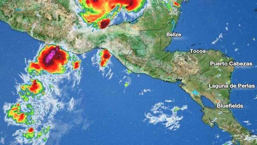
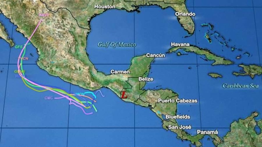
At 100 PM CDT (1800 UTC), the center of Tropical Storm Julia was located inland near latitude 12.4 North, longitude 86.2 West. Julia is moving toward the west near 16 mph (26 km/h), and this motion is expected to continue today, with a slightly slower west-northwestward motion tonight and Monday. On the forecast track, the center of Julia is expected to continue moving over Nicaragua today and emerge off the Pacific coast by this evening. Julia is then expected to move very near to and parallel to the Pacific coasts of Honduras, El Salvador, and Guatemala tonight and Monday.
Maximum sustained winds have decreased to near 60 mph (95 km/h) with higher gusts. Additional weakening is forecast during the next day or two, but Julia is still expected to be a tropical storm when it moves near the Pacific coasts of Nicaragua, Honduras, and El Salvador tonight and Monday. Julia is expected to dissipate near the coast of Guatemala by Monday night.
Tropical-storm-force winds extend outward up to 90 miles (150 km) from the center.
The estimated minimum central pressure is 996 mb (29.41 inches).

Watches and Warnings
CHANGES WITH THIS ADVISORY:
None.
SUMMARY OF WATCHES AND WARNINGS IN EFFECT:
A Tropical Storm Warning is in effect for, * Pacific coast of Nicaragua * Pacific coast of Honduras * Coast of El Salvador
A Tropical Storm Watch is in effect for, * Pacific coast of Guatemala
A Tropical Storm Warning means that tropical storm conditions are expected somewhere within the warning area, in this case within the next 24 hours.
A Tropical Storm Watch means that tropical storm conditions are possible within the watch area, in this case within the next 24 to 36 hours.
For storm information specific to your area, please monitor products issued by your national meteorological service.

Land Hazards
Key messages for Julia can be found in the Tropical Cyclone Discussion under AWIPS header MIATCDAT3 and WMO header WTNT43 KNHC and on the web at hurricanes.gov/text/MIATCDAT3.shtml.
WIND: Tropical storm conditions are expected along the Pacific coasts of Nicaragua, Honduras, and El Salvador within the warning area beginning this afternoon through Monday morning. Tropical storm conditions are possible along the Pacific coast of Guatemala within the watch area on Monday.
RAINFALL: Julia is expected to produce the following rainfall accumulations through Tuesday:
Nicaragua and El Salvador, 5 to 10 inches, isolated 15 inches. Honduras, Belize, northern Guatemala, and the Isthmus of Tehuantepec in Mexico, 3 to 6 inches, isolated 10 inches. San Andres, Providencia, and western Panama, an additional 2 to 4 inches, isolated 12 inch storm total amounts. Southern Guatemala and Costa Rica, 4 to 8 inches, isolated 12 inches.
This rainfall may cause life-threatening flash floods and mudslides across Central America today and Monday. Flash flooding is anticipated across the Isthmus of Tehuantepec in Mexico early this week.
SURF: Swells generated by Julia are affecting Jamaica, Providencia, and San Andres, and the coast of Central America. These swells are likely to cause life-threatening surf and rip current conditions. Please consult products from your local weather office.


