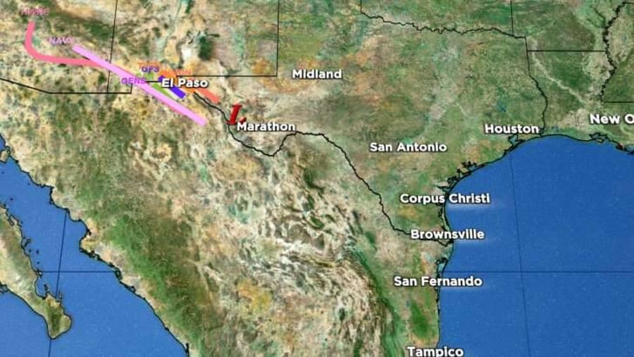
| Location | 155 miles SE of El Paso Texas |
| Wind | 25 mph |
| Heading | NW at 24 mph |
| Pressure | 29.83 |
| Coordinates | 104.4W, 30.4N |
Recommended Videos
Discussion
At 1000 AM CDT (1500 UTC), the remnants of Harold were located near latitude 30.4 North, longitude 104.4 West. The remnants are moving toward the northwest near 24 mph (39 km/h) and this motion is expected to continue today. The surface low is forecast to become increasingly ill-defined, eventually being absorbed into a thermal trough situated from northern Mexico into New Mexico. This process make the surface reflection of Harold difficult to track beyond this evening. Therefore, this will be the final advisory.
Maximum sustained winds are near 25 mph (35 km/h) with higher gusts.
The estimated minimum central pressure is 1010 mb (29.83 inches).

Watches and Warnings
SUMMARY OF WATCHES AND WARNINGS IN EFFECT:
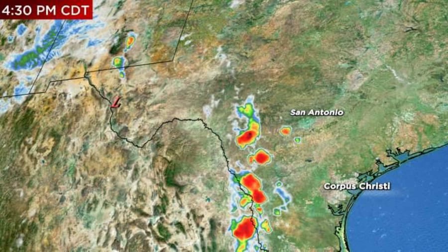
A Flood Watch is in effect across portions of the Trans-Pecos and Big Bend regions of Texas. A small Flood Watch is in effect in the vicinity of Ruidoso, New Mexico.
Interests in Southwestern U.S. And northern Mexico should continue to monitor the progress of this system.
For storm information specific to your area, including possible inland watches and warnings, please monitor products issued by your local National Weather Service forecast office.

Land Hazards
Key messages for Harold can be found in the Tropical Cyclone Discussion under AWIPS header TCDAT4 and WMO header WTNT44 KWNH and on the web at www.hurricanes.gov.
RAINFALL: Harold is expected to produce additional rainfall amounts of 1 to 2 inches with isolated storm totals of 4 inches across Trans Pecos region of Texas today, mainly west of the Big Bend. Isolated to widely scattered instances of flash flooding are possible.
In far northern Mexico, rainfall amounts of 1 to 2 inches with local amounts of 4 inches are expected through today across northern portions of Chihuahua. Isolated instances of flash flooding are expected with landslides possible.
WIND: Winds could be particularly gusty in and near areas of elevated terrain across far northern Mexico and west Texas through Wednesday. Higher gusts could persist even after the surface system dissipates.

